
Data Foundation: From Raw Data to Structured Intelligence
The first step of the DIVA methodology, where fragmented data is transformed into a structured and reliable foundation for analysis.
This layer ensures data consistency, traceability, and readiness for analytical and spatial processing within the DIVA system.
Data Processing Pipeline
Raw data is processed through a structured pipeline to ensure consistency, validation, and integration into the DIVA database system.
Raw Data → Staging Layer → Structured Database
Raw Data
Heterogeneous data collected from multiple sources, including statistical, geospatial, and institutional datasets.
Staging Layer
Intermediate processing layer where data is cleaned, validated, and standardized before integration.
Structured Database
Final structured storage system where data is organized into relational tables, ready for analysis and integration.
The structured database integrates indicators, metadata, and geospatial data into a unified relational system supporting analysis and decision-making.
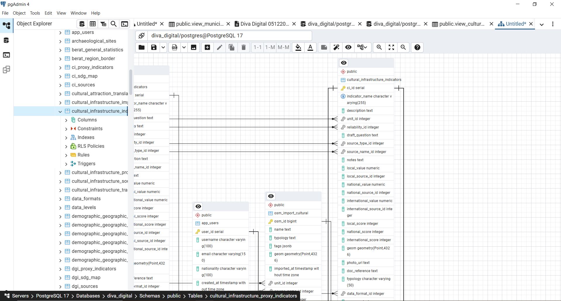
This structured foundation enables integration across multiple data layers within the DIVA system.
Once data is structured, it is integrated across multiple layers to support cross-domain territorial analysis.
Data Layers and Integration

Core indicator tables storing structured territorial data, including demographic, economic, tourism, and environmental indicators.

Geospatial data layers (PostGIS) enabling spatial analysis, mapping, and territorial visualization.

Event-based data linked to specific locations and timeframes, supporting dynamic territorial analysis.

Data on agritourism activities, including location, status, and territorial relevance within rural systems.
External geospatial data integrated from OpenStreetMap to enrich local datasets and support spatial completeness.
Metadata structure including source type, source name, reliability level, and measurement units ensuring data traceability and consistency.
These layers are interconnected through a unified data model enabling cross-domain analysis
From Data Structuring to Decision Support
Transforming structured data into policy-relevant territorial intelligence
Within the DIVA system, structured data is not only stored but actively transformed into analytical outputs that support spatial analysis, indicator monitoring, and evidence-based territorial decision-making. By integrating statistical, geospatial, and metadata layers, DIVA enables a continuous transition from data collection to actionable insights.

Thematic Maps
Spatial visualization of integrated indicators through GIS layers, enabling the identification of territorial patterns, disparities, and spatial dynamics.

Indicator Dashboards
Multi-dimensional aggregation of indicators presented through dashboards, supporting comparative analysis, trend evaluation, and performance monitoring across territories and sectors.

Decision Support
Structured analytical outputs designed to inform planning processes, policy development, and strategic interventions, ensuring traceable and data-driven decision-making.
Example Analytical Outputs
The following examples illustrate how structured data within the DIVA system can be queried and transformed into analytical outputs.
Structured data can be queried and transformed into analytical outputs.
Indicator Distribution by Source Type
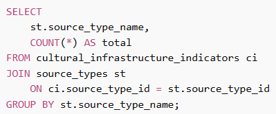
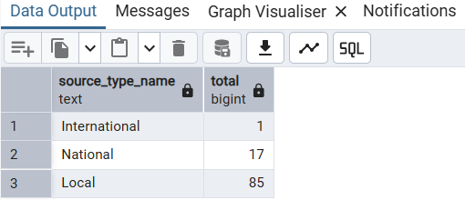
This query shows how indicators are distributed across different source types, supporting data reliability assessment.
GIS OUTPUT
Reusable Analytical View
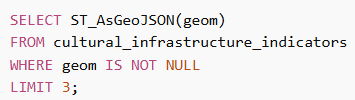
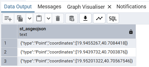
The system generates geospatial outputs in GeoJSON format, enabling integration with GIS platforms and web applications.
VIEW
Reusable Analytical View
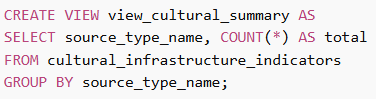
Views standardize analytical queries, enabling consistent reuse across dashboards and reporting tools.
Next Step
Once data is structured and integrated, it can be transformed into indicators and analytical insights, forming the basis for decision-making.