Transforming Data into Actionable Insights
Turn Territorial Data into Decision Intelligence
A Territorial Intelligence framework that transforms data, governance signals, spatial knowledge, and institutional insights into actionable decisions for municipalities, communities, and researchers.
Born from the pilot experience of Berat. Developed through research, innovation, and collaboration with institutions and local communities, with a vision that extends beyond a single territory.
The Origins of DIVA
DIVA was born from the observation of a reality that is both simple and recurring: valuable information already exists, yet it is often scattered across documents, archives, databases, technical reports, and different sources.
Through years of research activities, institutional collaboration, and fieldwork, it became evident that the availability of data did not necessarily coincide with the ability to understand it in an integrated manner. Information useful for planning, enhancing local resources, and understanding territorial dynamics was frequently fragmented and difficult to connect.
The pilot experience developed in the territory of Berat represented the starting point of this journey. Through research, experimentation, and digital innovation activities, the project progressively evolved with the objective of making territorial information more accessible, organized, and easier to interpret.
Although it originated within a specific context, DIVA was conceived with a vision that extends beyond a single territory, maintaining the objective of supporting knowledge, enhancement, and integrated understanding of diverse territorial realities.
From Data to Decision Intelligence
DIVA integrates:
- Data structuring
- Spatial analysis
- Indicator-based modeling
→ into a unified decision-support system.
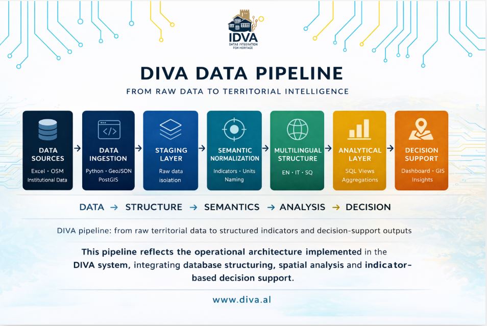
How DIVA Works
The DIVA approach is aligned with international frameworks such as the UN Sustainable Development Goals.
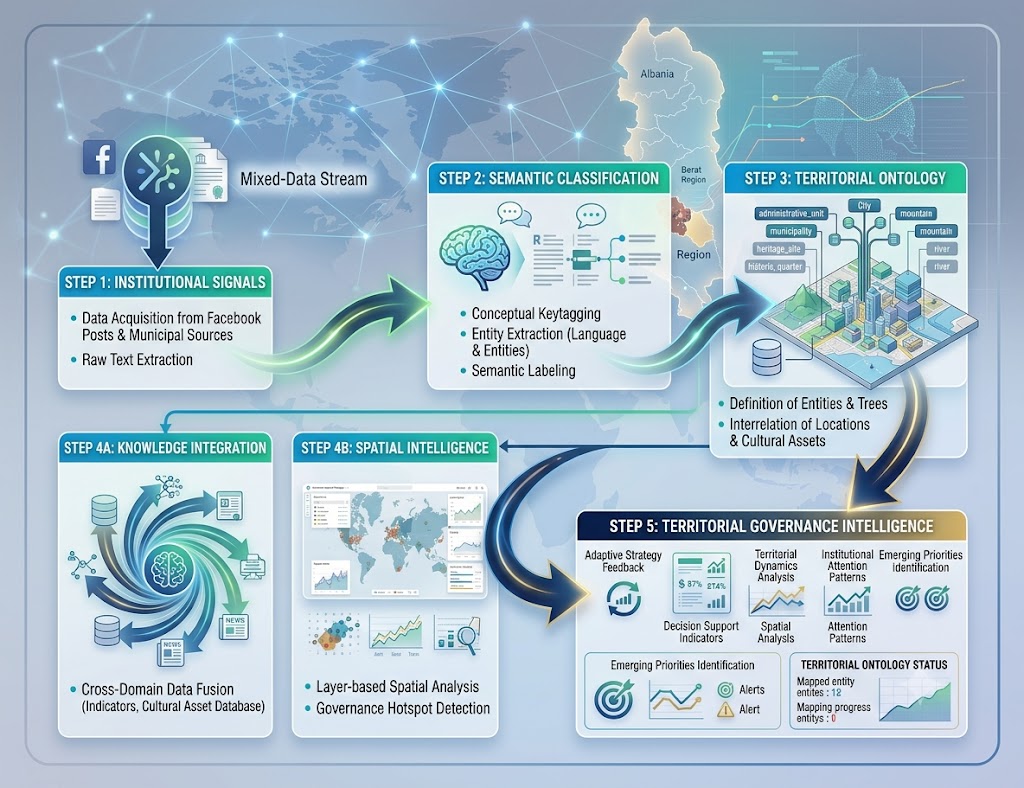
Adaptive Territorial Governance Intelligence
Transforming institutional signals, territorial knowledge and spatial data into adaptive governance intelligence.
Governance Fragmentation
→ Information Boundaries
→ Knowledge Integration
→ Territorial Intelligence
→ Adaptive Governance
Governance Signals

Institutional Priorities
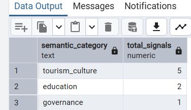
Institutional Attention
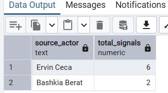
Territorial Ontology Layer
DIVA connects municipalities, administrative units, villages, heritage assets, cultural landscapes, and governance signals inside a unified territorial ontology.
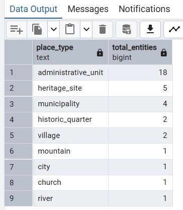
DIVA transforms governance signals, territorial entities, spatial knowledge, and institutional information into adaptive territorial intelligence.
Where DIVA Creates Impact
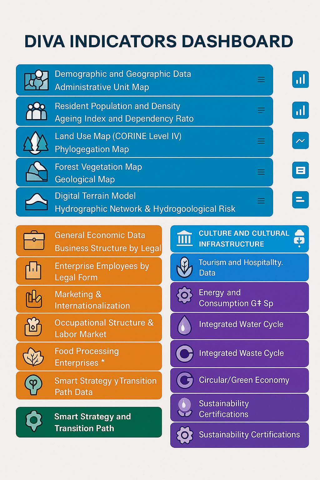
DIVA applies structured data across key territorial domains to support planning and decision-making.
Environmental Intelligence
Supports climate planning and risk monitoring
Cultural Intelligence
Integrates cultural data to support heritage preservation and local identity strategies.
Tourism Intelligence
Supports tourism planning and local economic strategies through data-driven insights.
Governance & Community Engagement
Enables transparent decision-making and stakeholder coordination through structured territorial data.
Territorial Governance Intelligence
Identifies emerging territorial priorities, institutional attention patterns, and governance dynamics through semantic and spatial analysis.
System Architecture
DIVA is built on a structured architecture that transforms territorial data into decision-ready intelligence.
The system operates through four core components:
Standardizes and integrates heterogeneous territorial data into a consistent structure.
Analytical Layer
Transforms structured data into indicators, aggregations, and actionable insights.
Spatial Integration
Applies geospatial processing to map and analyze territorial dynamics.
Decision Support
Delivers dashboards and tools to support planning, governance, and strategy.
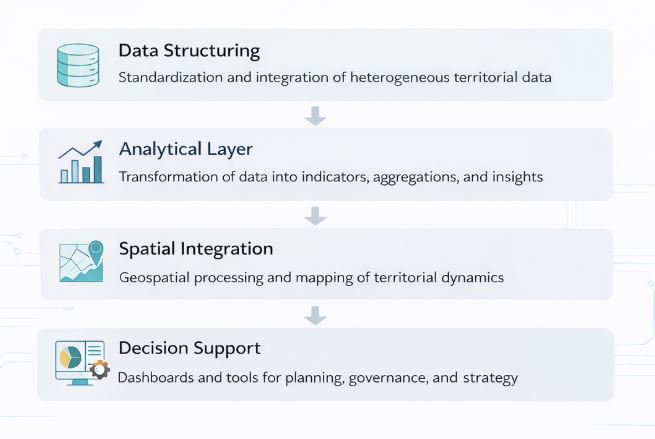
This architecture ensures that data flows from collection to decision-making in a structured and replicable way.
What DIVA Produces
DIVA transforms territorial data, institutional signals, and territorial knowledge into structured intelligence for governance, planning, and decision-making.
Structured Indicators
Standardized and comparable indicators across
demographic, economic, tourism, cultural,
environmental, and governance domains.
Indicators
Knowledge Assets
Strategic concepts, territorial entities,
and contextual knowledge integrated into
a reusable territorial intelligence framework.
100 Knowledge Assets (87 Indicators + 13 Concepts)
Governance Signals
Institutional communications transformed into
structured governance observations through
semantic and spatial analysis.
Governance Signals
Decision Intelligence
Maps, dashboards, territorial ontologies,
and governance intelligence outputs supporting
evidence-based decision-making.
Territorial Entities
87 Indicators • 13 Strategic Concepts
• 100 Knowledge Assets • 41 Governance Signals
Together, these assets form an Adaptive Territorial Governance Intelligence framework capable of integrating data, knowledge, institutional signals, and spatial intelligence into actionable decisions.
Exploring the Territorial Context
Pilot implementation: Municipality of Berat (Albania)
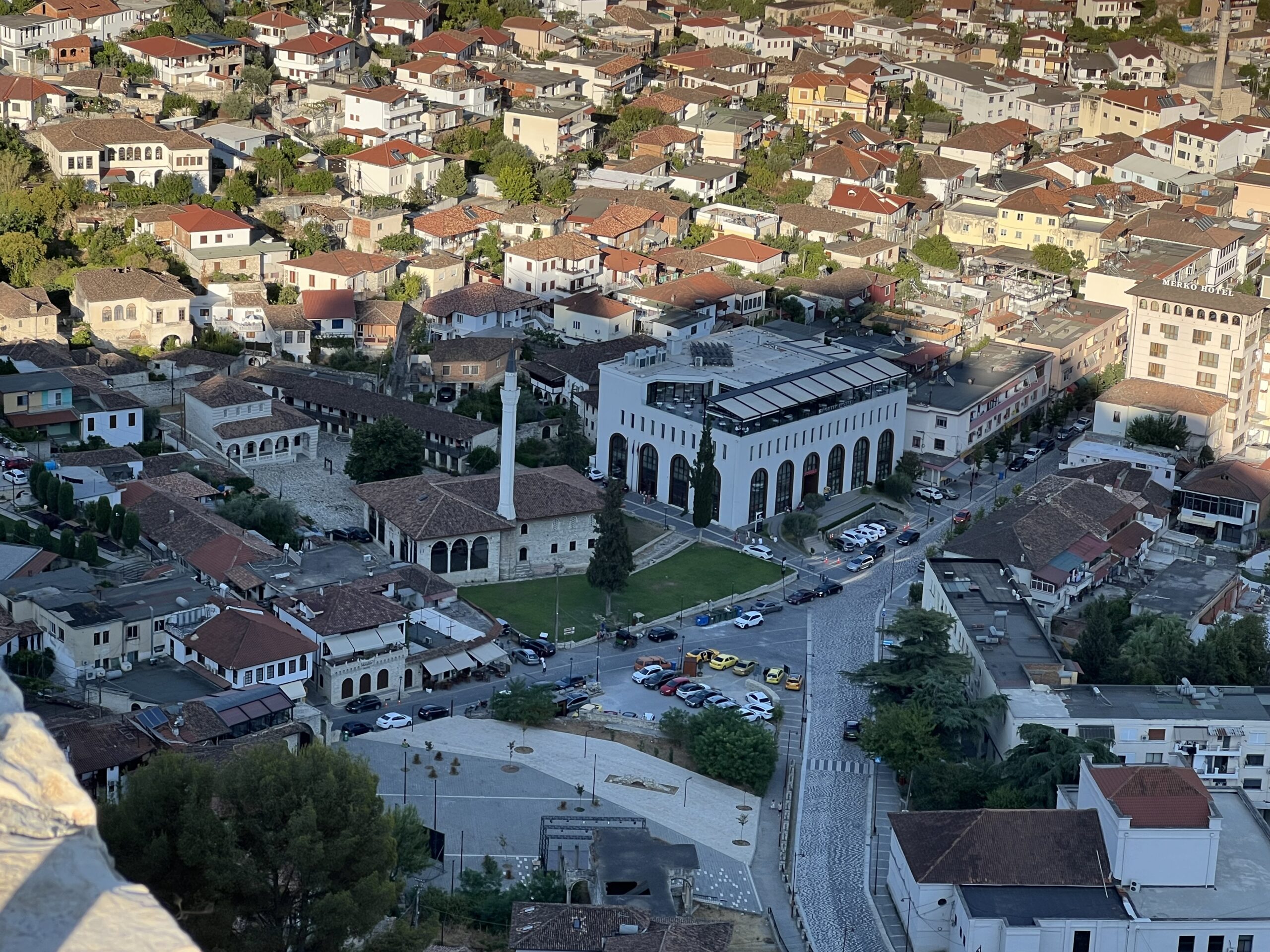

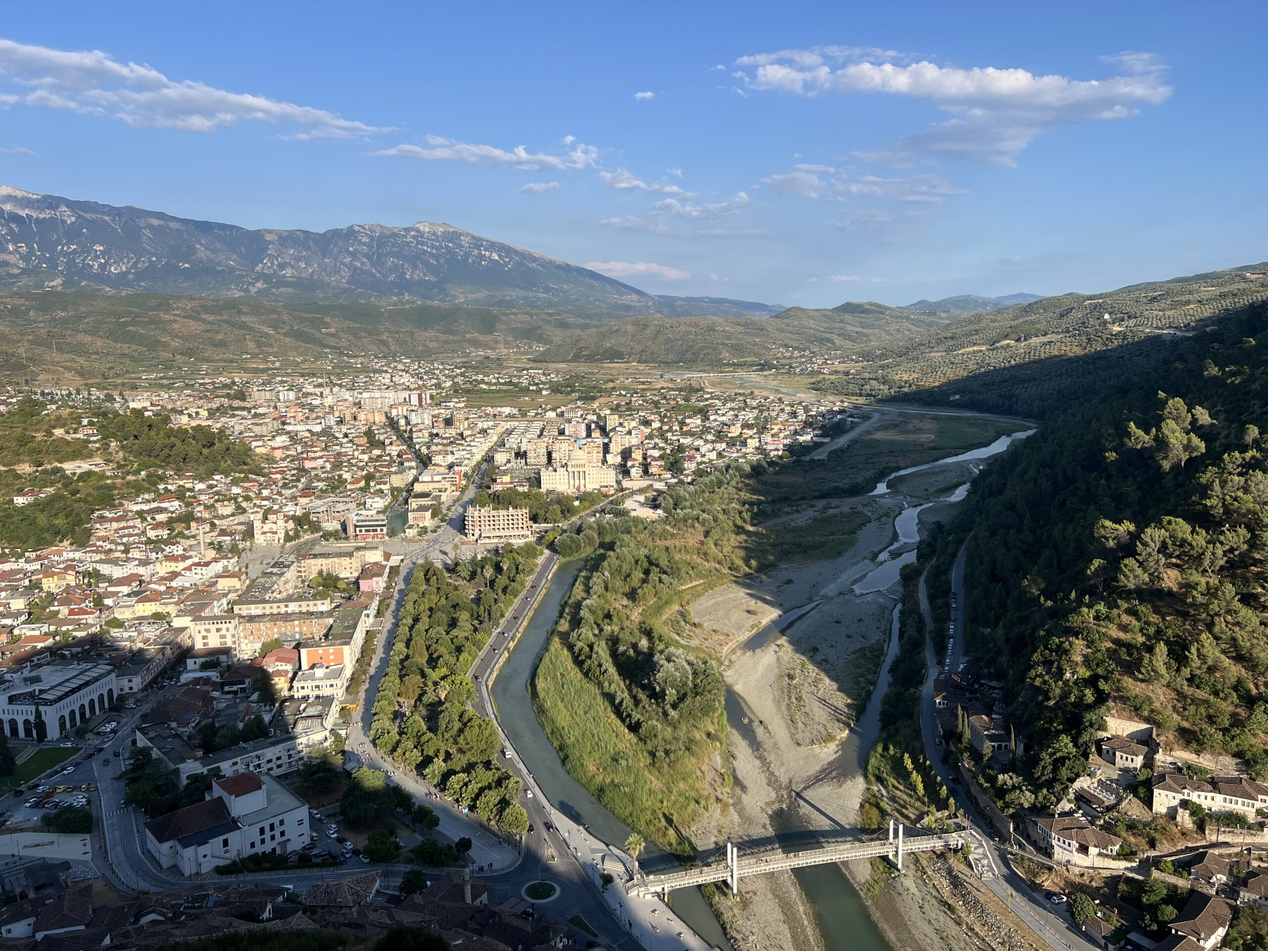
Berat represents a complex territorial system where cultural heritage, tourism, and economic activities interact.
DIVA enables the structured analysis of these dynamics.
Institutional Validation
Official collaboration with the Municipality of Berat
“DIVA provides critical insights for cultural heritage planning and preservation”
Ervin CECA
Mayor of the Municipality of Berat

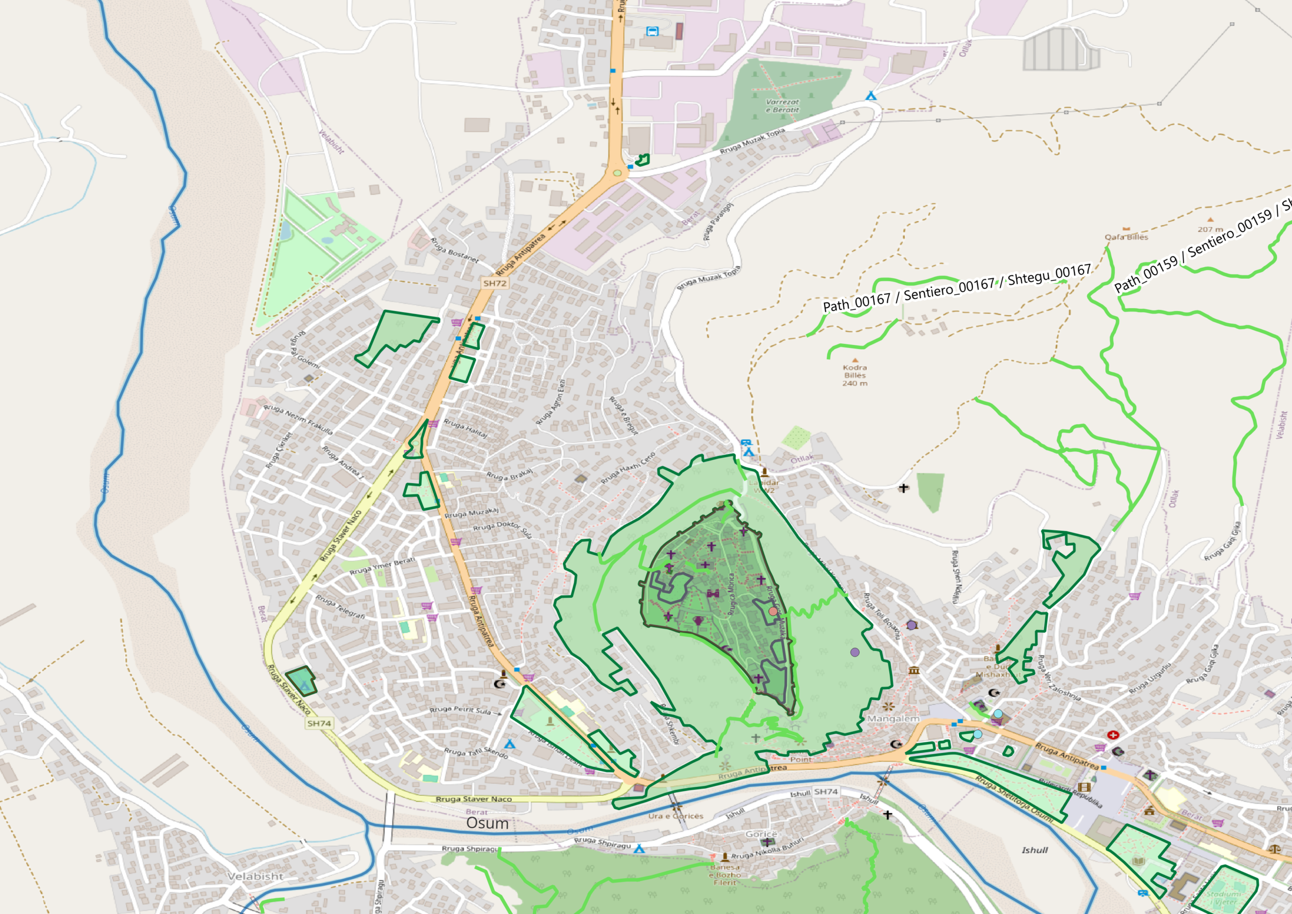
Implement the DIVA System in Your Territory
Bring structured data and decision intelligence into your municipality.