
Transforming Data into Actionable Insights
Turn Territorial Data into Decision Intelligence
A data-driven platform for municipalities to transform territorial data into actionable decisions.
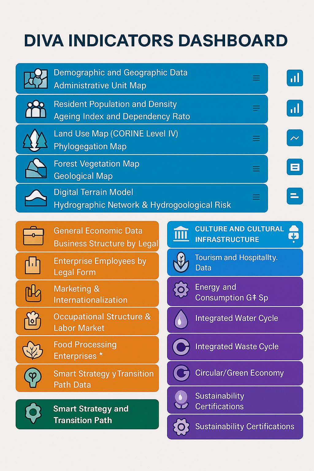
From Data to Decision Intelligence
DIVA integrates:
- Data structuring
- Spatial analysis
- Indicator-based modeling
→ into a unified decision-support system.
How DIVA Works
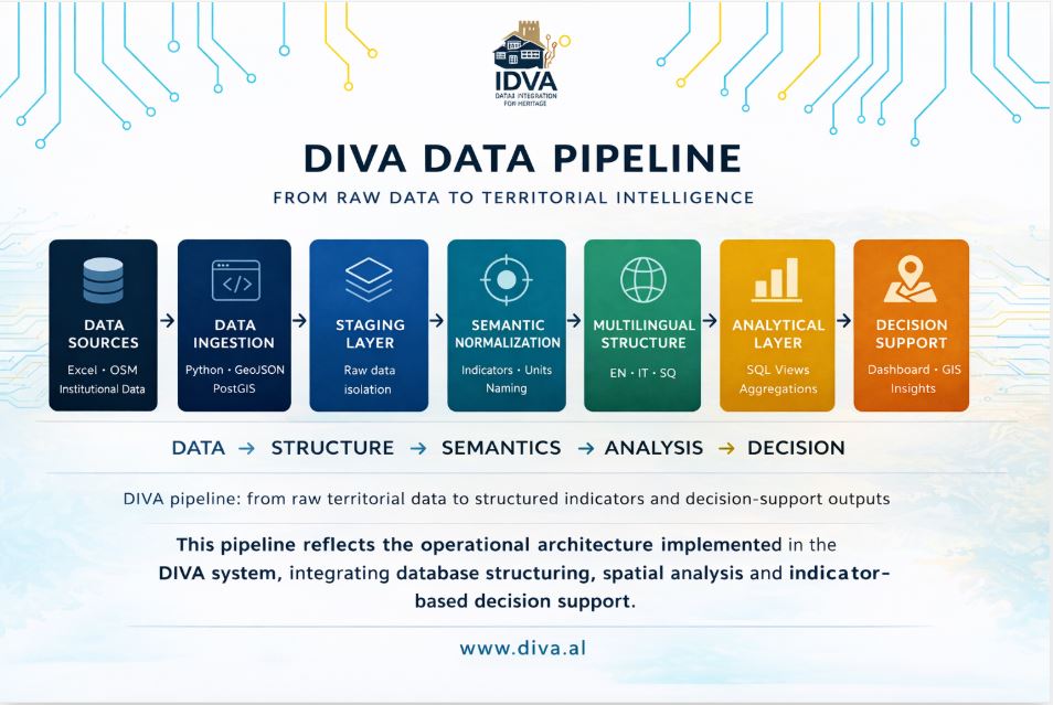
The DIVA approach is aligned with international frameworks such as the UN Sustainable Development Goals.
Where DIVA Creates Impact
DIVA applies structured data across key territorial domains to support planning and decision-making.
Environmental Intelligence
Supports climate planning and risk monitoring
Cultural Intelligence
Integrates cultural data to support heritage preservation and local identity strategies.
Tourism Intelligence
Supports tourism planning and local economic strategies through data-driven insights.
Governance & Community Engagement
Enables transparent decision-making and stakeholder coordination through structured territorial data.
System Architecture
DIVA is built on a structured architecture that transforms territorial data into decision-ready intelligence.
The system operates through four core components:
Standardizes and integrates heterogeneous territorial data into a consistent structure.
Analytical Layer
Transforms structured data into indicators, aggregations, and actionable insights.
Spatial Integration
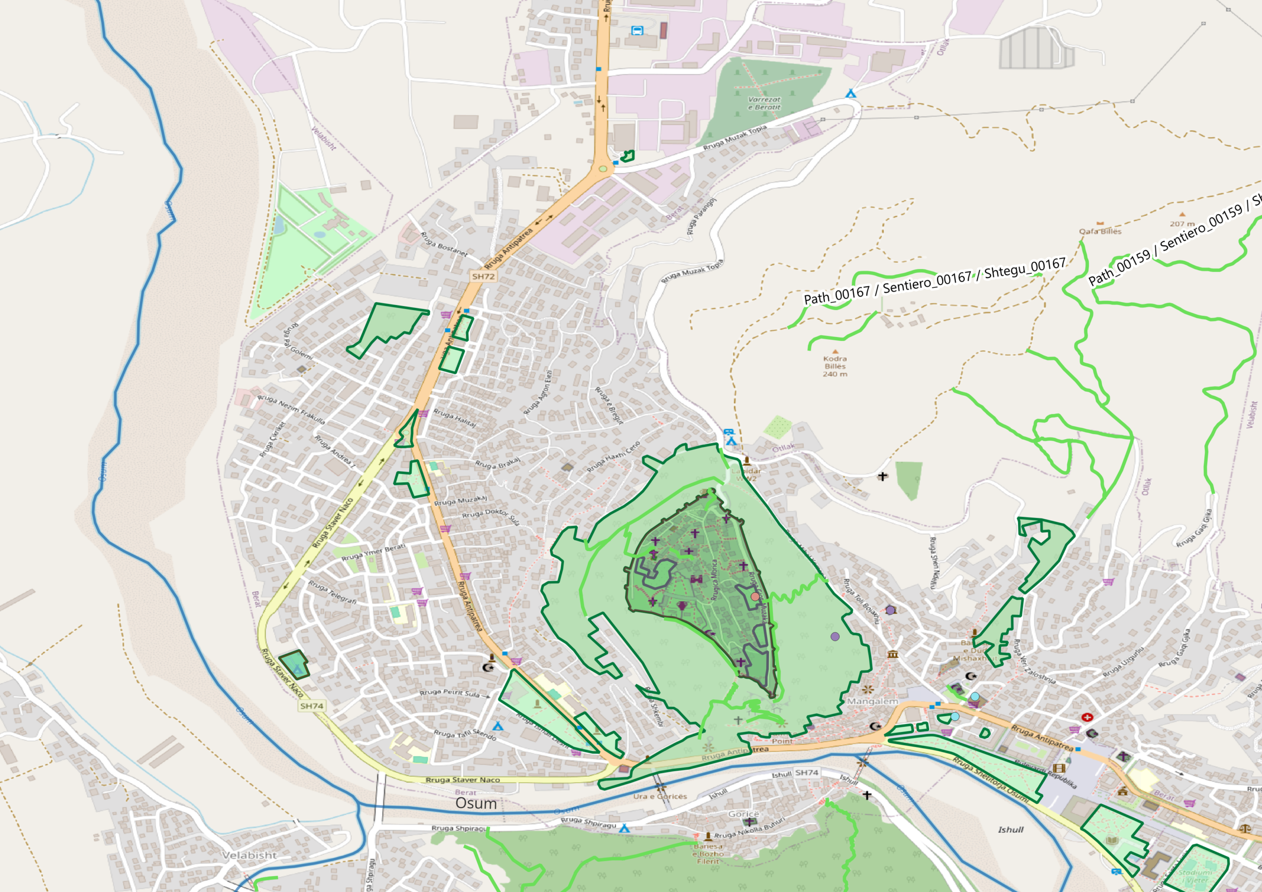
Applies geospatial processing to map and analyze territorial dynamics.
Decision Support
Delivers dashboards and tools to support planning, governance, and strategy.
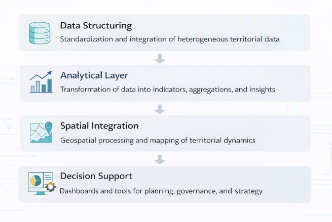
This architecture ensures that data flows from collection to decision-making in a structured and replicable way.
What DIVA Produces
DIVA transforms territorial data into structured outputs that directly support analysis and decision-making.
Structured Indicators
Standardized and comparable indicators across territorial domains.
Analytical Outputs
Aggregated data, comparisons, and insights used to support data-driven decisions.
Decision Support Tools
Dashboards, maps, and tools designed for planning, governance, and strategy.
100+ structured indicators across key territorial domains
These indicators form the foundation for analysis, comparison, and policy-oriented decision-making.
Exploring the Territorial Context
Pilot implementation: Municipality of Berat (Albania)
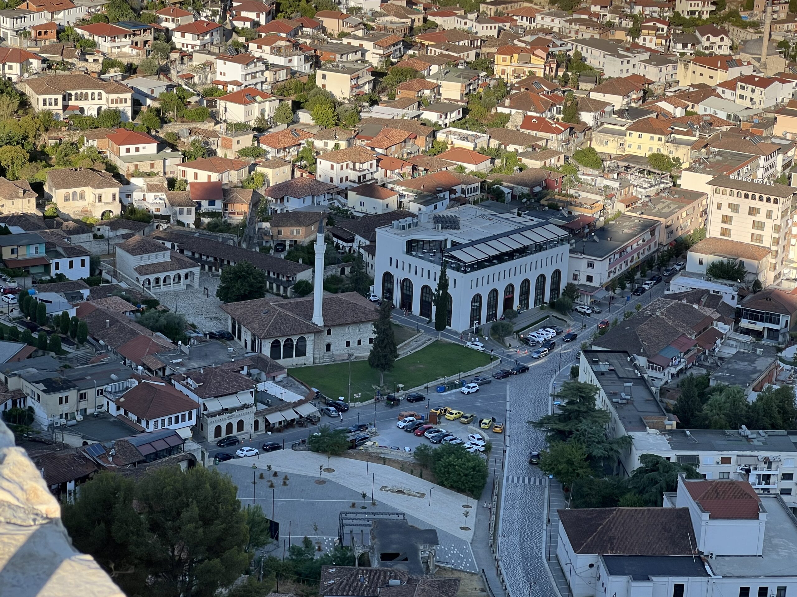

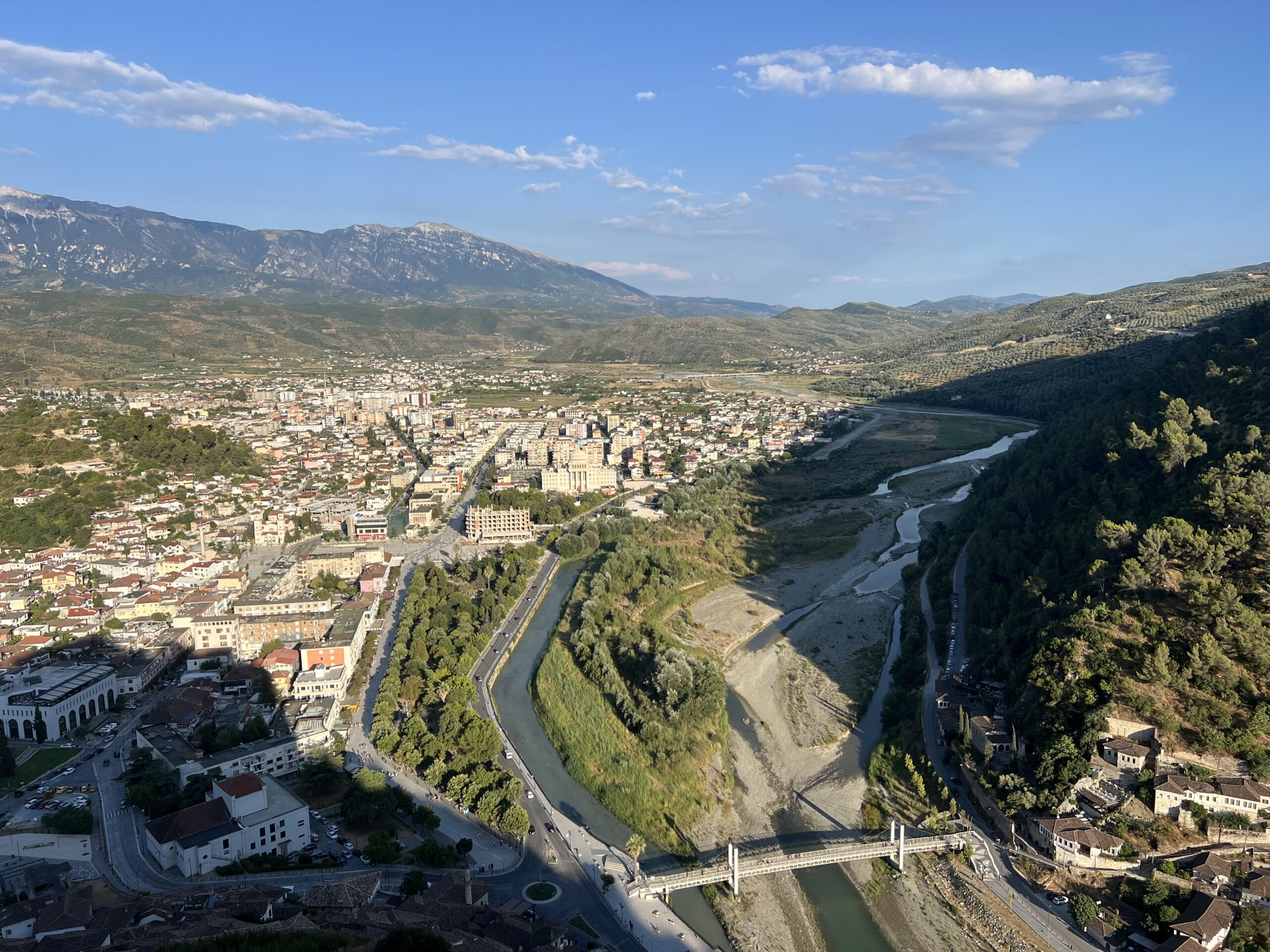
Berat represents a complex territorial system where cultural heritage, tourism, and economic activities interact.
DIVA enables the structured analysis of these dynamics.
Institutional Validation
Official collaboration with the Municipality of Berat
“DIVA provides critical insights for cultural heritage planning and preservation”
Ervin CECA
Mayor of the Municipality of Berat

Implement the DIVA System in Your Territory
Bring structured data and decision intelligence into your municipality.